In Montgomery, a city built on the sedimentary formations of the Gulf Coastal Plain, we often see a sharp contrast between the stiff, overconsolidated clays of the Selma Chalk to the north and the looser terrace deposits near the Alabama River floodplain. This lateral variability makes it nearly impossible to extrapolate a single borehole log across a site, which is precisely why we turn to surface geophysics. Electrical resistivity imaging lets our team map these transitions without disturbing the ground, delivering continuous profiles that highlight clay layers, sand lenses, and the depth to weathered rock that governs foundation selection. When a few SPT borings alone cannot capture the full picture, we complement the drilling campaign with a seismic refraction survey to nail down the rippability of the chalk, and then run a dense resistivity grid to track the groundwater table across the parcel before a single excavator bucket breaks ground.
A resistivity low in the Selma Chalk may flag a water-filled cavity, not just wet clay — cross-check it with borehole control before calling the concrete truck.
How we work
Local context
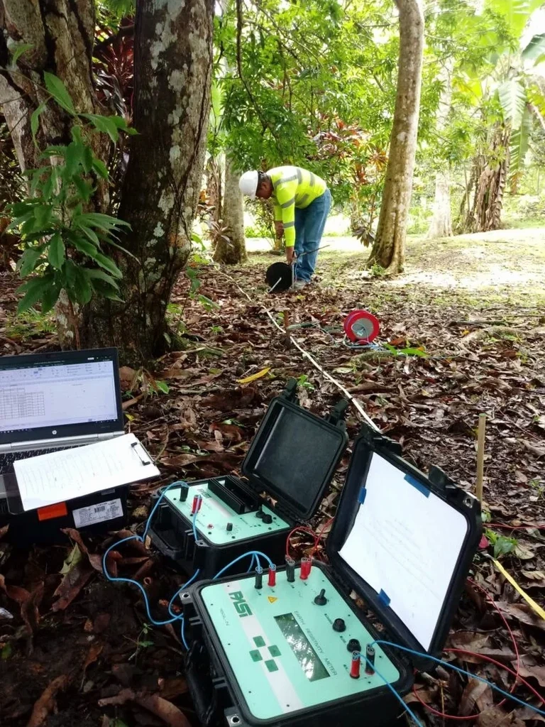
We run the ABEM Terrameter LS2 on Montgomery sites because its built-in electrode switch box handles the long cable spreads we need for deep VES soundings, and it rejects the 60 Hz noise that industrial corridors along the I-65 belt can induce. The crew plants stainless-steel stakes in a straight line, checks contact resistance at each electrode, and waters the ground with a saline solution if the surface is too dry, which happens often in August when the topsoil shrinks and cracks. The greatest risk in resistivity work here is misinterpreting a low-resistivity anomaly as groundwater when it is actually a pocket of expansive Yazoo Clay, a mistake that can lead to under-designed footings and slab heave within the first wet season. We mitigate this by correlating every resistivity low with at least one direct-push soil sample or an in-situ permeability test, so the geophysical interpretation is always ground-truthed before it reaches the structural engineer's desk.
Relevant standards
ASTM D6431-18 Standard Guide for Using the Direct Current Resistivity Method for Subsurface Site Characterization, ASCE 7-22 Minimum Design Loads and Associated Criteria for Buildings and Other Structures, 2021 International Building Code (IBC), Chapter 18 Soils and Foundations, Alabama Department of Transportation (ALDOT) Soil Survey Guidelines (referenced for right-of-way investigations)
Additional services
1D Vertical Electrical Sounding (VES)
Point soundings with expanding electrode spacing to resolve layer resistivity and thickness at a single location. Ideal for borrow pit evaluation and pre-drilling reconnaissance.
2D Electrical Resistivity Tomography (ERT)
Multi-electrode profiles processed into continuous cross-sections. We use this to map the top-of-rock surface, delineate sand channels, and locate the seasonal groundwater table.
Borehole-to-Surface Resistivity
One current electrode placed in an existing borehole, the other at the surface, to create a focused image of strata around the hole. Useful for verifying the lateral extent of a clay seam found during drilling.
Utility & Void Detection Surveys
High-density dipole-dipole arrays with 3-foot electrode spacing to locate buried drums, USTs, or solution cavities in the Selma Chalk before excavation begins.
Typical parameters
Quick answers
How much does a VES resistivity survey cost for a half-acre lot in Montgomery?
For a typical half-acre residential or light commercial lot in Montgomery, a VES survey with three to five soundings and a basic 2D profile generally falls between US$600 and US$930. The spread depends on the number of electrode lines, the depth of investigation required, and whether we need to bring in extra cable to avoid buried utility conflicts.
Can resistivity tell the difference between Yazoo Clay and clean sand?
Yes, and that distinction is critical for Montgomery sites. Yazoo Clay typically reads below 15 ohm-m due to its high cation exchange capacity, while clean sands of the terrace deposits usually exceed 100 ohm-m when dry and drop to 30–60 ohm-m when saturated. We always calibrate the resistivity range with at least one soil sample to confirm the material type.
How deep can you see with a resistivity survey in the Selma Chalk?
With a Schlumberger array and a total current-electrode spread of 300 feet, we can reliably resolve resistivity contrasts down to approximately 100–120 feet, which is sufficient to map the transition from weathered chalk to competent limestone. For deeper targets, we extend the spread or switch to a downhole resistivity log, but most Montgomery foundation questions are answered within the top 60 feet.